Topographic data collection has changed a lot over the years. What once took days of fieldwork can now be done in a fraction of the time. RTK drones capture data with high accuracy, and combined with photogrammetry and 3D modeling, the result is a clear, detailed view of any site.
2D orthomosaic maps stitch high-resolution aerial images into a single accurate map. Point clouds are built from millions of data points, each representing a specific location in space, for volume calculations, terrain models, and topographic maps.
Nothing here needs rebuilding at your end. Deliverables come out of Pix4D and DroneDeploy ready for Civil 3D and ArcGIS.
Hundreds of overlapping frames stitched into one georeferenced, measurable map of the whole site.
Millions of measured points, each a real position in space, built into a textured model you can rotate and measure.
Digital surface and terrain models with contours, ready to drop straight into an existing CAD or GIS workflow.
Stockpile and earthworks quantities measured off the model instead of paced out on foot with a wheel.
The measured ground control points and the check against known coordinates — the evidence behind the accuracy claim.
cm-level
RTK positioning accuracy
GCP
Ground-control verified
24-48 h
Typical turnaround
Anyone can fly a grid and produce something that looks like a map. The difference is whether the numbers survive being checked.
Site boundary, required accuracy, and deliverable formats agreed first, then ground control point layout planned to suit — density and placement follow the accuracy the job actually needs.
GCP layoutRTK-positioned aircraft fly repeatable lines with fixed overlap and altitude. Repeatability is what makes a second visit comparable to the first.
RTKPhotogrammetric processing in Pix4D or DroneDeploy, then the result checked against measured control points rather than trusted because the GPS said so.
GCP verifiedExported to the formats your team already works in, with the verification record attached so the accuracy claim is auditable.
24-48 hWhat once took days in the field now takes a flight and a processing run. The output is the same shape as the fieldwork it replaces.
Measurable site maps for planning, coordination, and dispute evidence, repeated through a build so every stage has a record.
Terrain models, contours, and corridor mapping delivered as DXF and DSM, dropping into Civil 3D without a rebuild.
Stockpile volumes and pit topography measured from the model, repeatably enough to compare month to month.
Georeferenced base imagery and terrain data for asset management and planning, in formats ArcGIS already reads.
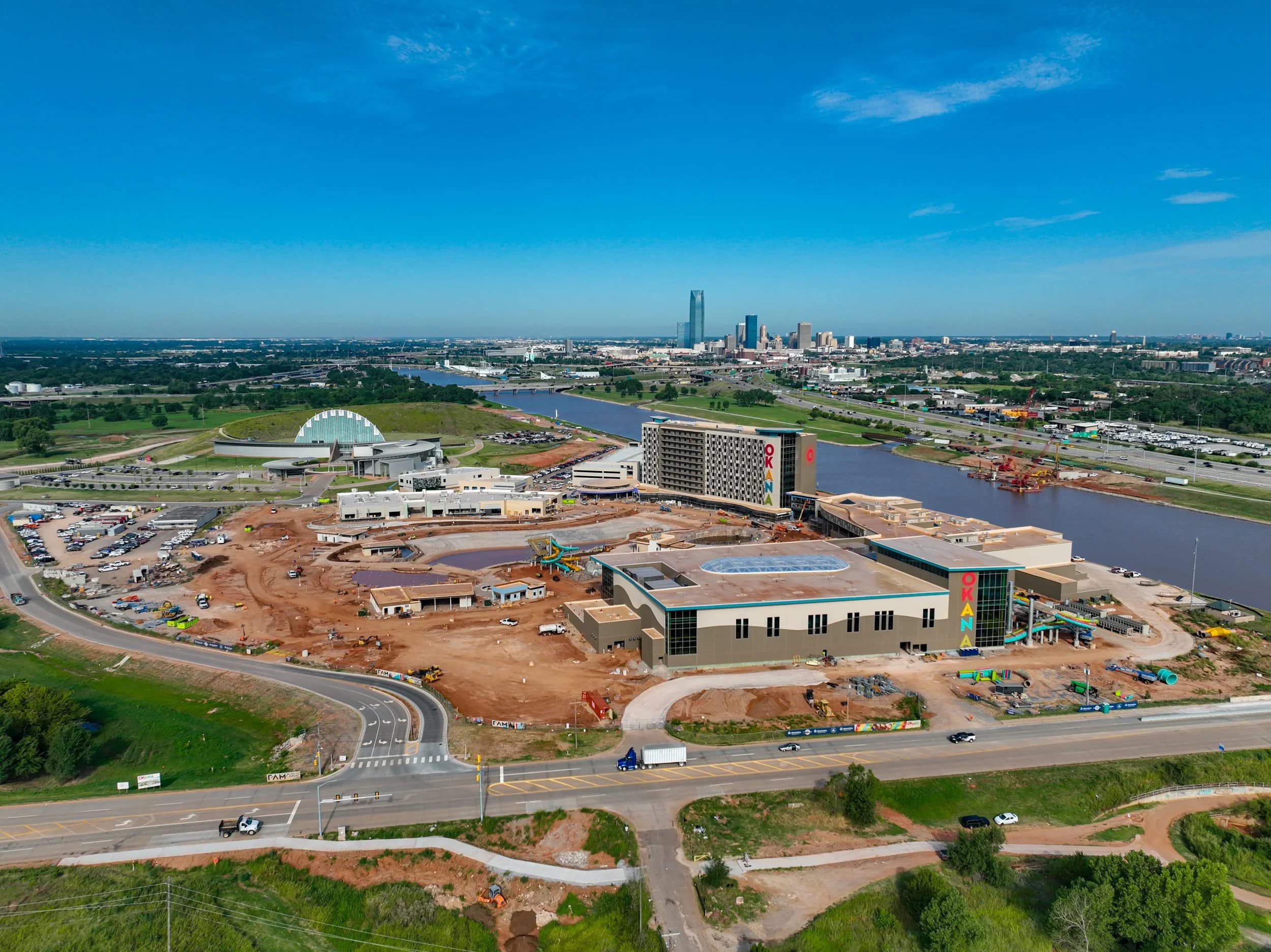
Campus, stadium, resort, and course mapping across Oklahoma — including the Chesapeake campus 3D model and orthomosaic work over the University of Oklahoma.
Every one of these is an accuracy claim someone could check, which is why ground control points get measured on site rather than skipped because the RTK looked good.
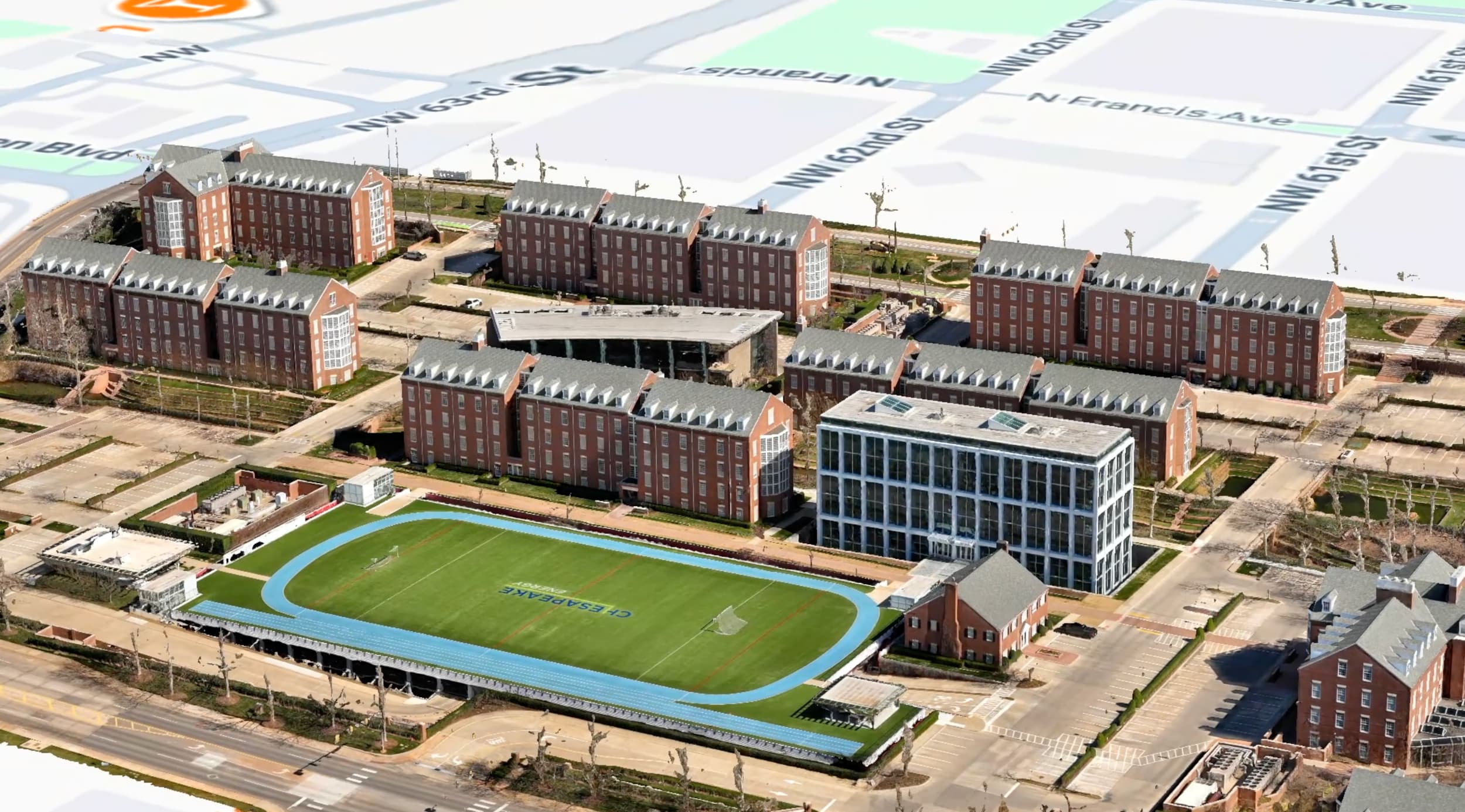
Chesapeake Campus · 3DPhotogrammetric 3D model of the Chesapeake campus, Oklahoma City.
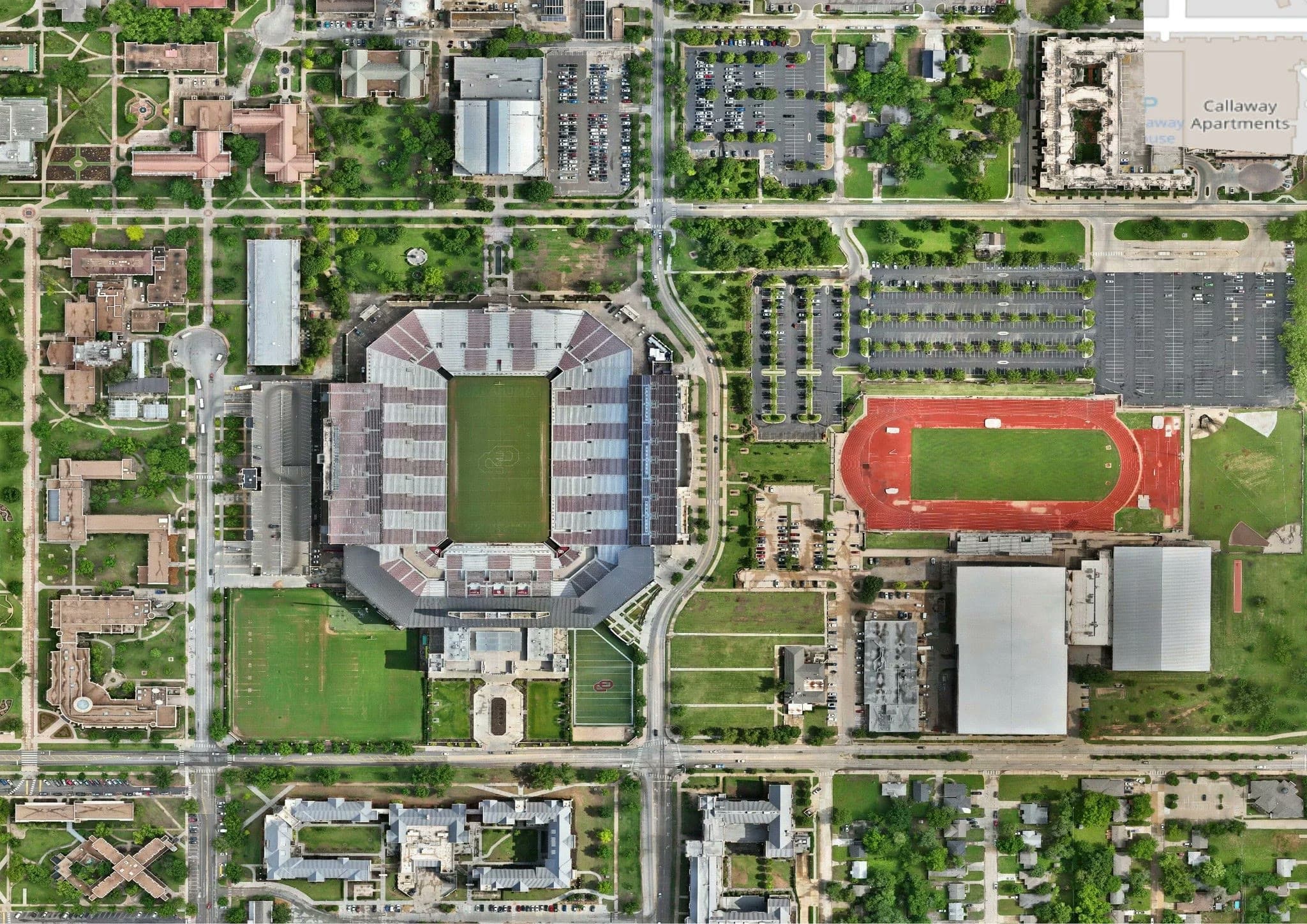 OU Stadium · Ortho
Orthomosaic over the University of Oklahoma stadium and track.
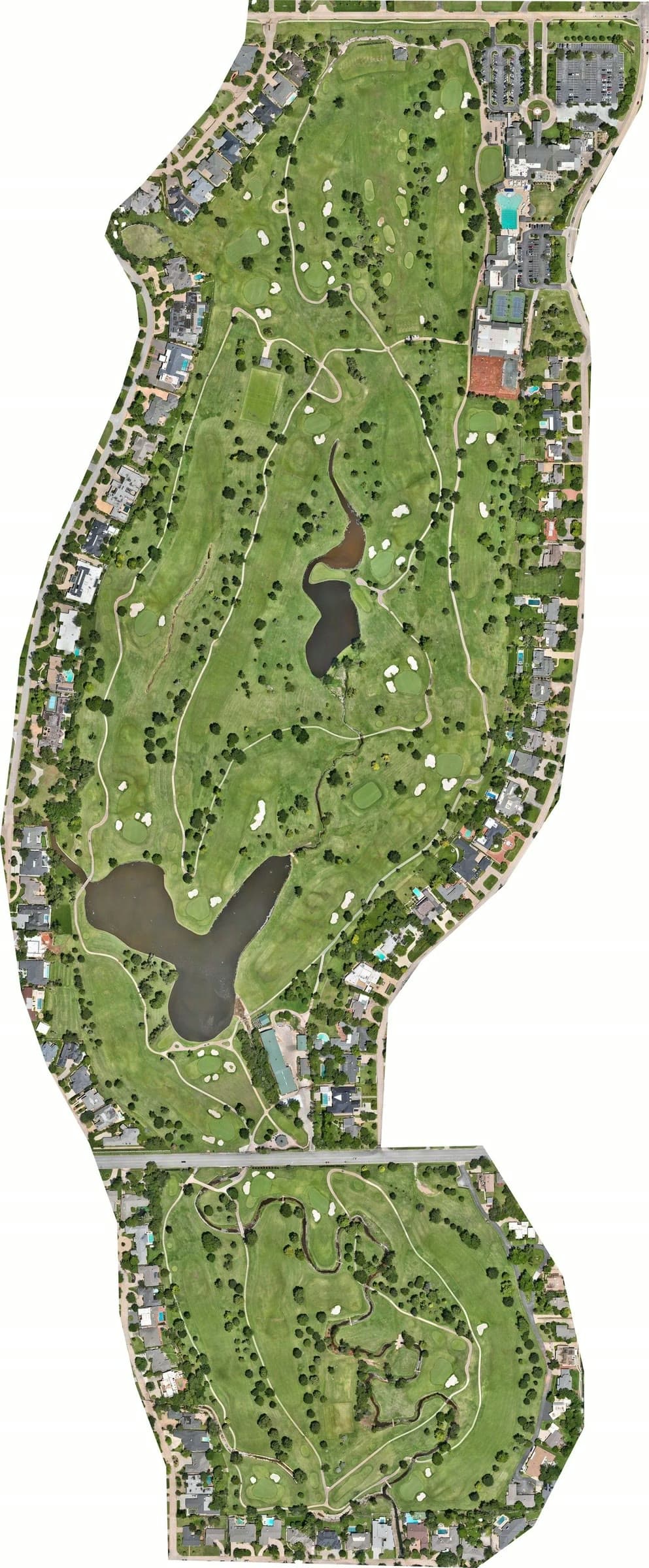 Golf Course · Ortho
Full-coverage orthomosaic of a golf course, stitched from a single grid flight.
Centimetre accuracy. The aircraft carry RTK positioning, and we measure ground control points on site to verify the result rather than take the GPS at its word. If a number is going into a design or a claim, it gets checked against known coordinates first.
No, and we're straight about that: Aerial Perceptions is a drone mapping and photogrammetry operation, not a licensed land surveying firm. What we deliver is aerial data collection — orthomosaics, point clouds, terrain models, and volumes — which replaces a great deal of the fieldwork and is typically used on its own for progress, quantities, and planning. Where a legal boundary or a stamped drawing is required, this data goes to a licensed surveyor to work from rather than standing in for one.
GeoTIFF and JPG for 2D orthomosaics; LAS and OBJ for point clouds and 3D models; DSM, DTM, and DXF for terrain and contours; CSV and a report for volume calculations. Produced through Pix4D and DroneDeploy and handed over ready for Civil 3D and ArcGIS.
Most single sites are a one-day flight. Area coverage depends on the resolution you need — a high-detail model of a building takes longer per acre than a broad topographic pass over open ground — so tell us the accuracy requirement and we'll tell you the flying time.
Yes, and that's where most of the value is. Flights are repeatable — same grid, same altitude, same control — so a second visit produces a dataset directly comparable to the first, for progress, volume change, or settlement.
Yes, briefly. Ground control points have to be physically placed and measured before the flight, which means someone walking the site. It's the step that separates a verified map from a nice-looking one.