What Is Drone Mapping Used For?
You may have heard about aerial drone mapping services and wondered what makes them such a big deal. Is it just about cool aerial shots, or is there more going on behind the scenes? The short answer is simple. Drone mapping turns aerial data into clear, usable insights that help businesses make faster and smarter decisions.
Let’s break it down in a way that actually makes sense.Why Your Purpose Matters First
Start with a simple question. What do you need the drone to do?
Are you capturing real estate shots? Filming cinematic footage? Tracking site progress? Each use needs a slightly different setup.
A drone for casual photos will not perform the same on a construction site. You need accuracy, repeatable flight paths, and reliable data capture. If your work involves inspections or mapping, your drone becomes more than a camera. It becomes a tool.
What Is Drone Mapping?
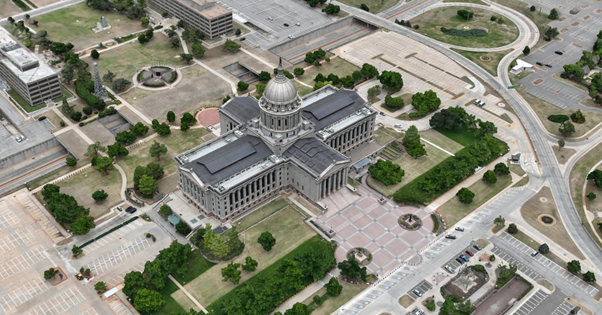
Think of drone mapping as a smarter way to capture land, buildings, and job sites from above. A drone flies over a specific area and takes hundreds, sometimes thousands, of high-resolution images.
Software then stitches those images together into:
Detailed maps
3D models
Accurate measurements
It is not just about visuals. It is about turning images into data you can actually use.
How Drone Mapping Works
Let’s keep it simple.
A drone follows a planned flight path. It captures images at precise intervals. Those images get processed using mapping software. What you get at the end is not just a photo. It is a complete digital representation of a space.
You can measure distances, check elevations, and even track changes over time.
Sounds technical, but the result feels very practical.
Where Drone Mapping Is Used
Here is where things get interesting. Drone mapping is not limited to one industry.
Construction Sites: Project managers use it to track progress, manage materials, and keep timelines on track. No guesswork. Just clear visuals and data.
Real Estate: Agents use mapping to show property layouts, land size, and surrounding features. Buyers get a better sense of space without stepping on site.
Agriculture: Farmers monitor crop health, irrigation patterns, and soil conditions. It helps reduce waste and improve yield.
Infrastructure Inspections: Bridges, roofs, and towers can be inspected without putting people at risk. That alone changes everything.
Emergency Response: Search teams use thermal and mapping tools to locate people faster. Time matters, and drone mapping helps save it.
Why Businesses Rely on Drone Mapping
Let’s be honest. Traditional methods can be slow, expensive, and sometimes risky.
Drone mapping changes that.
You get:
Faster data collection
Accurate measurements
Reduced labor costs
Better decision-making
At some point, most teams ask the same question. Why keep doing things the old way when a smarter option exists?
What Makes It Better Than Traditional Methods
Picture a survey team spending days collecting data on foot. Now picture a drone covering the same area in a few hours.
That difference matters.
Here is what stands out:
Speed: Large areas get mapped quickly. Projects move forward without delays.
Safety: No need for crews to climb or enter risky zones.
Accuracy: Modern drones use advanced positioning systems that capture precise data.
Cost Efficiency: Less manpower and faster turnaround lead to lower overall costs.Some businesses switch once and never look back.
Real Benefits You Can Expect
Let’s go beyond features and talk about real outcomes.
You get clearer project visibility. Teams stay aligned. Mistakes get spotted early. That alone can save time and money.
In the middle of all this, many companies turn to reliable drone mapping services to keep operations smooth and predictable.
You also gain a competitive edge. Better data leads to better decisions. Better decisions lead to stronger results.
Final Thoughts
Drone mapping is no longer a luxury. It is a practical tool that helps businesses work smarter, not harder.
If you are considering aerial drone mappingservices, it might be time to look at what your current process is missing. Better data leads to better outcomes.
At Aerial Perceptions LLC, we focus on delivering clear, reliable insights that support your goals. Our team works with you to turn aerial data into real results that make a difference where it counts.
FAQs
-
Aerial drone mapping services use drones to capture high-resolution images from above and convert them into detailed maps or 3D models. These services help businesses analyze land, structures, and project sites with accuracy while saving time and reducing manual effort.
-
Drone mapping offers faster data collection, improved safety, and high accuracy. Traditional surveying takes more time and often involves risk in difficult areas. Drones cover large spaces quickly and deliver precise results, which helps teams make better decisions without delays.
-
The main purpose of drone mapping is to provide clear, accurate data about a specific area. It helps with planning, monitoring, inspections, and analysis. Businesses use it to reduce guesswork, improve efficiency, and gain a better view of their projects from start to finish.
-
Aerial Perceptions LLC brings advanced technology, skilled pilots, and real field experience to every project. Their approach focuses on accuracy, safety, and practical results. Clients get reliable data, quick turnaround, and solutions that actually support better planning and execution.