Aerial Drone Mapping Services in Oklahoma City & Nationwide

Accurate Aerial Surveys with RTK Drones, Photogrammetry & 3D Models
Surveying has changed a lot over the years. What once took days in the field can now be done in a fraction of the time. With RTK-enabled drones and advanced software, data collection has become faster, more precise, and easier to manage. At Aerial Perceptions LLC, we focus on delivering reliable aerial drone mapping services that help teams make informed decisions without delay.
RTK drones allow us to capture data with high accuracy. When combined with photogrammetry and 3D modeling, the result is a clear, detailed view of any site. Our drone capture techniques are built to support real projects, from planning and design to ongoing development.
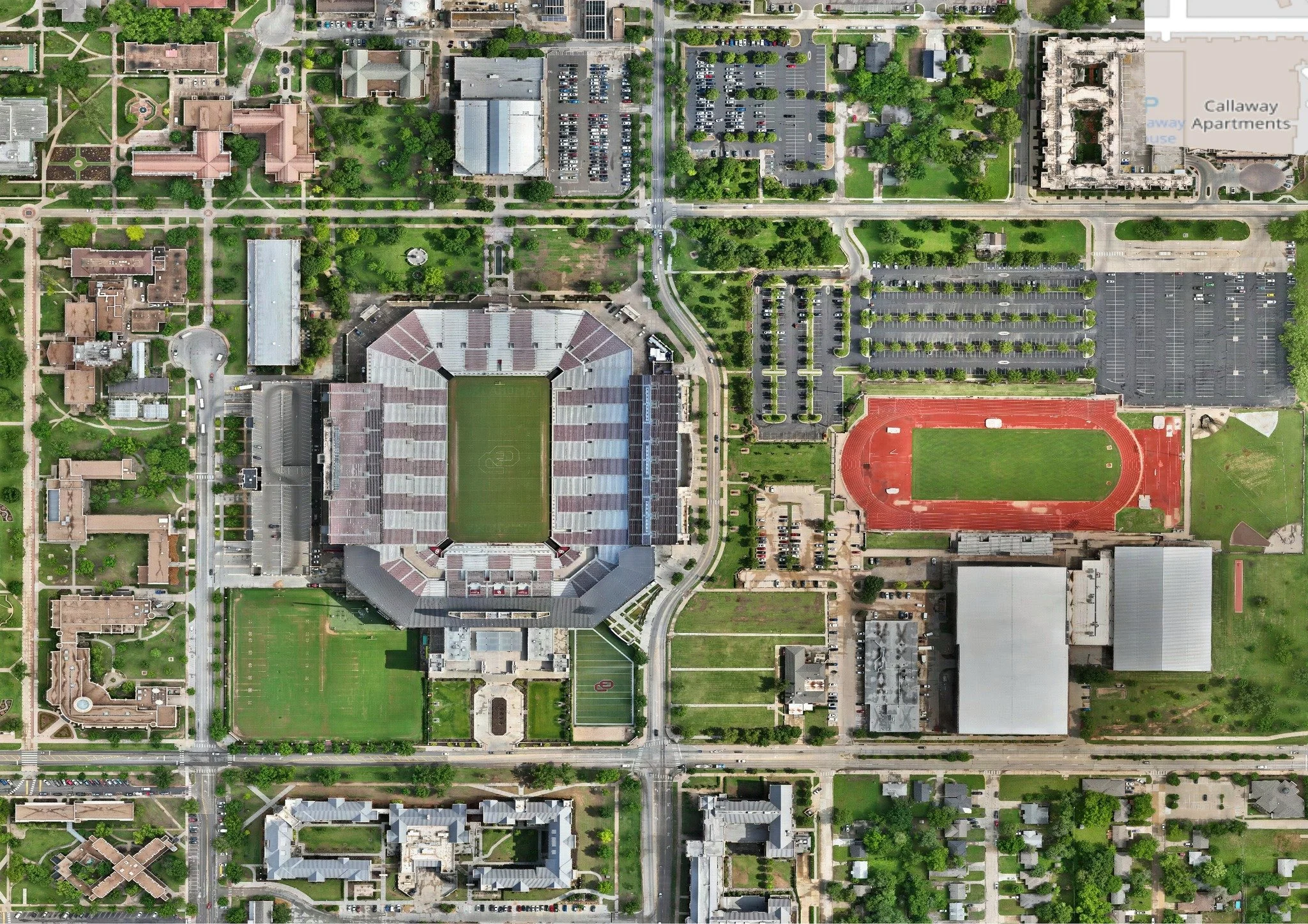
2D Orthomosaic Maps
Orthomosaic maps are one of the most common outputs in drone mapping. They provide high-resolution images that are stitched together to form a single, accurate map.
Unlike standard photos, these maps are corrected for distortion. This means measurements taken from them are reliable. With our proven aerial mapping services, clients receive deliverables that can be used for planning, analysis, and reporting.
These maps provide a clear overview of a site and help clients understand layout, boundaries, and key features without needing to be on location.
Point Clouds
Point clouds are made up of millions of data points collected from aerial images. Each point represents a specific location in space.
This data is highly detailed and can be used for precise measurements.
Point clouds are often used as a base for creating other models. They give teams a solid foundation for accurate analysis.
Industries We Serve
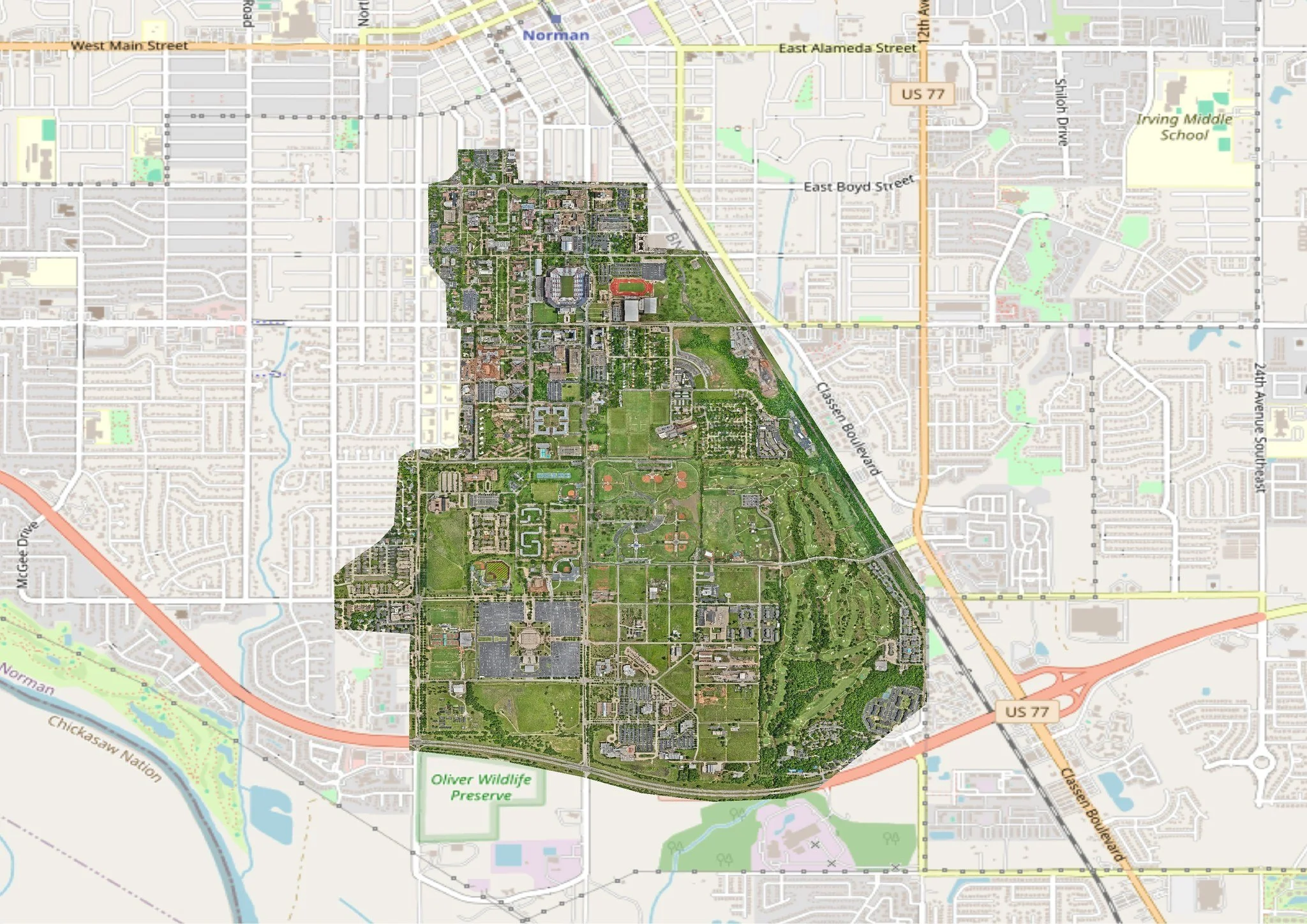
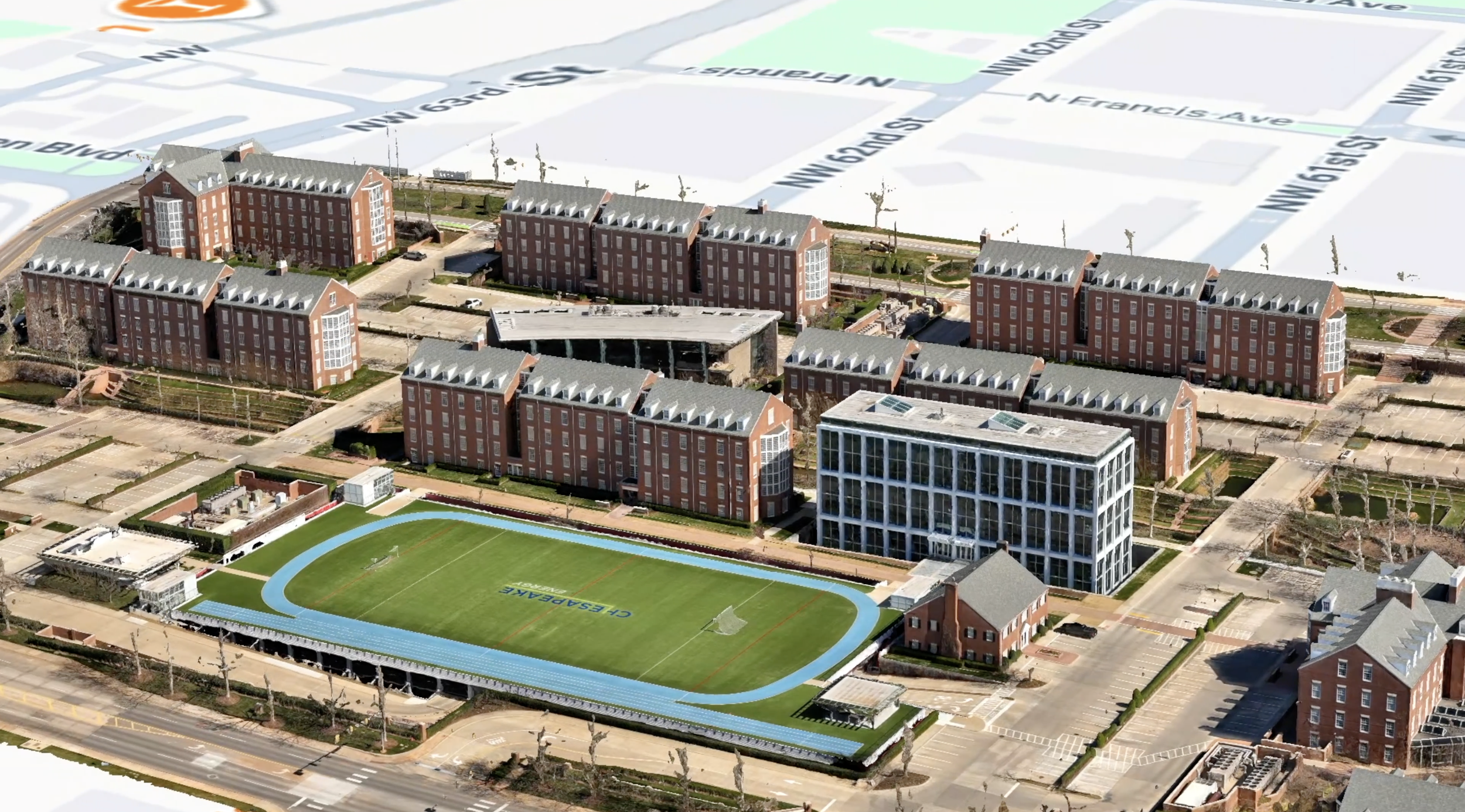
We provide aerial mapping for many industries and each one has its own needs, but the goal is the same. Get accurate data quickly and use it to make better decisions. Better decisions can prevent a costly mistake. At Aerial Perceptions LLC, we have been trusted by The University of Oklahoma, Manhattan Construction, OKANA, Cherokee Nation, Andretti Indoor Karting & Games, The State of Oklahoma and more.
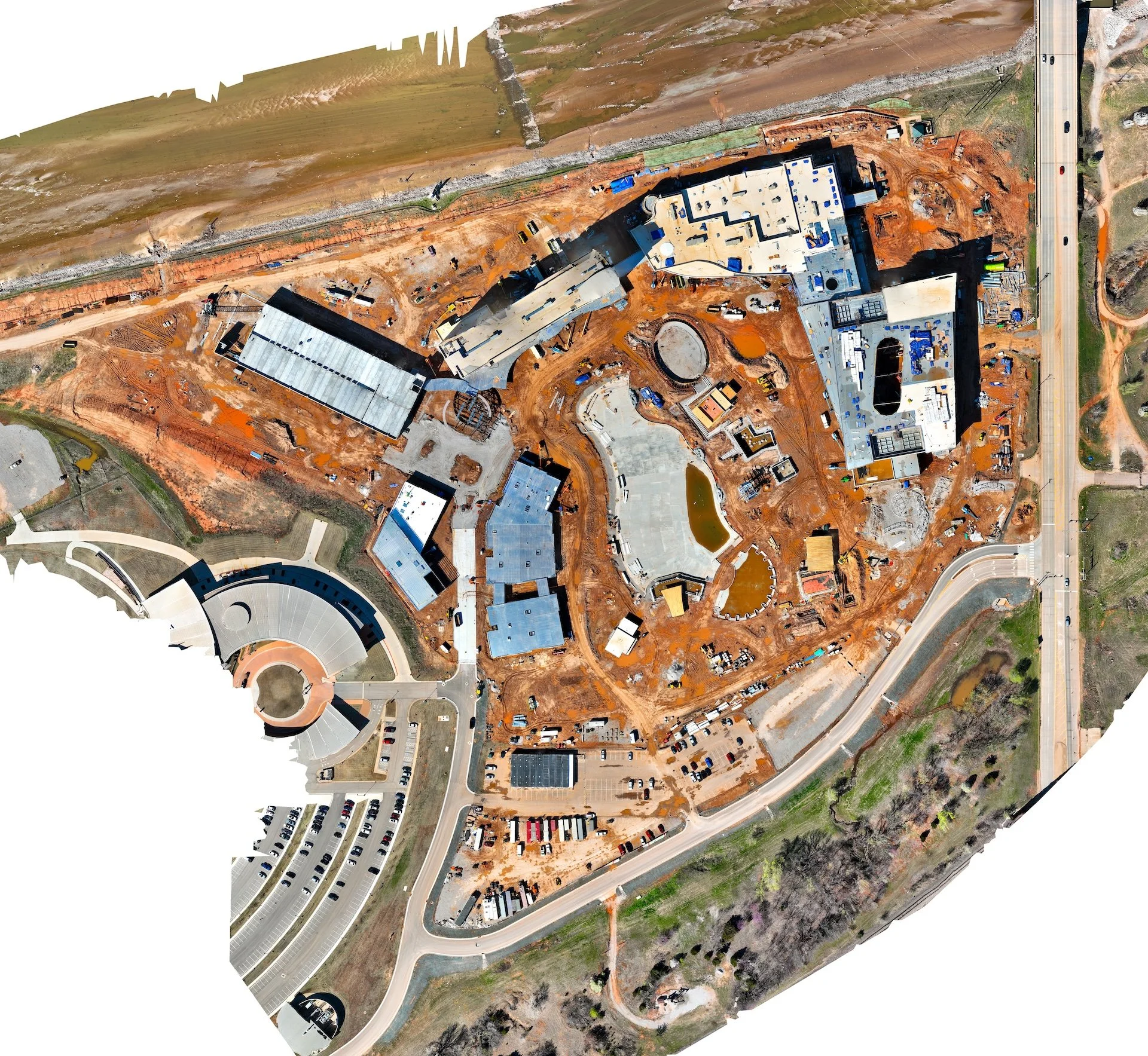
Construction & Development
Construction projects move fast. Teams need up-to-date data to stay on track.
Aerial Perceptions LLC can provide regular site updates to our clients and this helps track progress and spot issues early. It also improves communication between teams.
Accurate maps and models make it easier to plan each phase of a project.
Utilities & Oil & Gas
Utility and energy projects often cover large areas. Traditional surveys can take a long time.
Drones can capture these areas quickly and efficiently. Our data capture methods help teams monitor infrastructure and plan maintenance work.
Accurate data also improves safety in these environments.
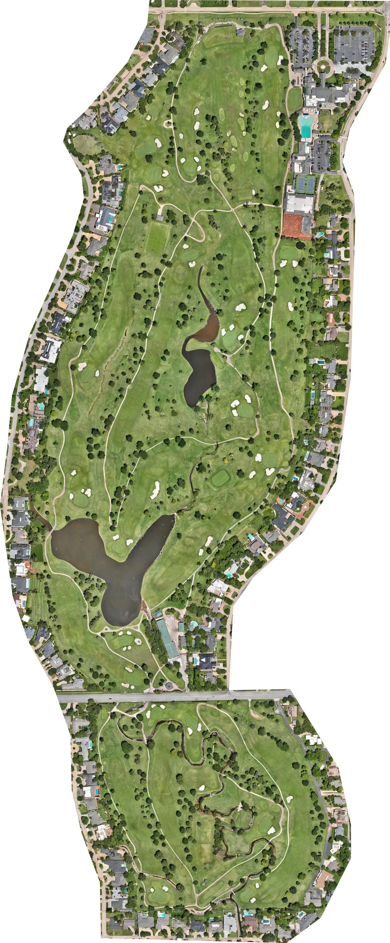
What is Drone Mapping?
Drone mapping is the process of capturing aerial images and turning them into usable data. It goes beyond simple photography. All images are processed using software to create accurate maps and models.
At Aerial Perceptions LLC, our mapping services combine field data with advanced processing tools. This allows us to create deliverables that engineers, surveyors, and project managers can actually use.
Faster Results
Speed is one of the biggest advantages. Data can be collected in hours instead of days.
Quick turnaround also means faster decisions.
Safety
Some sites are difficult or dangerous to access. This includes steep terrain, active construction zones, and industrial areas.
Using drones reduce the need for people to enter these environments. This improves safety for everyone involved.
Nationwide Drone Mapping & 3D Modeling
While we operate in Oklahoma, our services are not limited to one region. We also support projects across the country.
At Aerial Perceptions LLC, we have the knowledge and capabilities to adapt to different environments. Whether it is a large development site or a remote location, we bring the same level of precision.
3D Mesh Models
3D mesh models bring depth to aerial data. They show terrain and structures in a realistic way. This makes it easier to visualize how a site looks and how it might change over time.
With our 3D capture drones, we have the ability to create detailed 3D models that can be viewed from different angles. This is useful for presentations, planning, and design work.
These models help teams spot issues early and by seeing the site in 3D, it becomes easier to understand slopes, elevations, and structural details.
Digital Elevation Models (DEMs)
Digital Elevation Models show the height of terrain across a site. They are useful for understanding slopes, drainage, and elevation changes.
DEMs are created with high accuracy and this helps engineers plan projects with confidence. These models are also used in flood studies, grading plans, and land development. They provide a clear view of how the land behaves.
Civil Engineering
Civil engineers rely on precise data. Small errors can lead to big problems.
With our proven data capture methods, engineers get reliable information for design and analysis. This includes terrain data, elevation models, and site layouts.
Agriculture
Farmers and land managers need to understand their land. Soil conditions, drainage, and crop health all play a role.
We can provide clear data that supports better decision-making and this helps improve efficiency and reduce waste.
It also allows for better planning over time.
Scalable
Projects come in all sizes. Some require small surveys, while others cover large areas.
Our aerial drone mapping services can scale to match the project. This makes them suitable for both small and large operations.
Mining & Aggregates
Mining operations require constant monitoring. Stockpile volumes and site conditions change often.
Our advanced mapping services provide accurate volume calculations and site data. This helps operators manage resources more effectively.
It also reduces the need for manual measurements.
Government & GIS Applications
Government agencies use mapping data for planning and management. This includes land use, infrastructure, and environmental studies.
Our aerial mapping services provide accurate data that integrates with GIS systems. This supports long-term planning and analysis.
Benefits of Drone Mapping & 3D Modeling
Drone mapping & 3D capture offers several practical benefits. It improves how data is collected, processed, and used. At Aerial Perceptions LLC, our services are designed to deliver results that teams can rely on.
Cost Savings
Traditional surveys can be expensive. They require more time and manpower.
This makes mapping more accessible for many projects.
High Accuracy
Accuracy is critical in mapping. Small errors can affect the entire project.
Accurate data leads to better outcomes.
Contact Our Expert
Oklahoma Drone Mapping Services
Oklahoma offers a mix of landscapes, from open land to urban areas. Each project requires a different approach.
At Aerial Perceptions LLC, we have been providing sUAV mapping services in Oklahoma since 2016 and have worked with some of the biggest companies and organizations in the state. We understand local conditions and plan each mission accordingly.

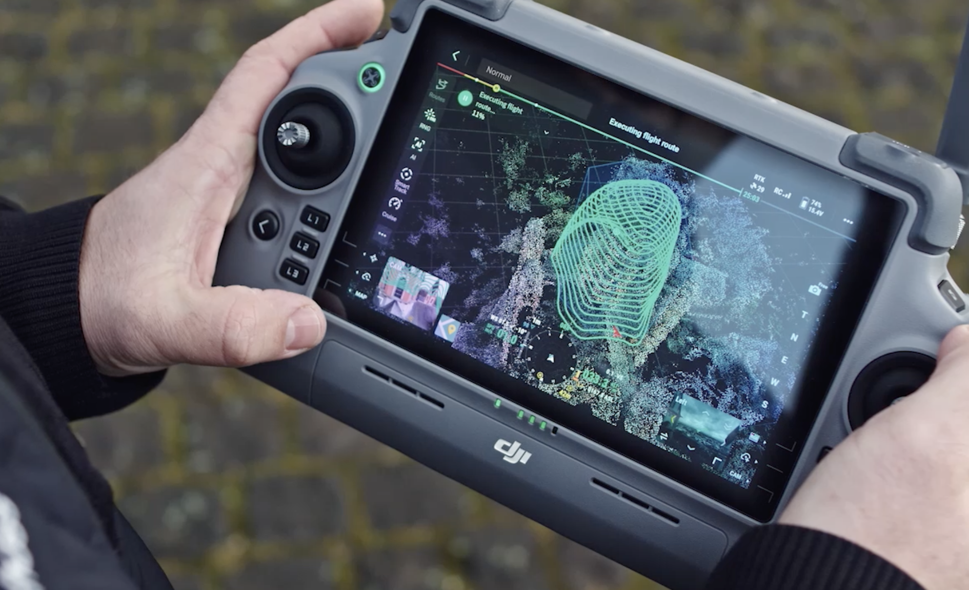
Our Technology & Deliverables
Technology plays a key role in the quality of mapping data. At Aerial Perceptions LLC, we use advanced RTK mapping drones to ensure high quality, sub-inch accuracy. Our drone mapping methods are supported by reliable hardware and software.
High-resolution aerial orthomosaics
We provide detailed orthomosaic maps that offer a clear view of the site. These maps are easy to use and support planning and analysis. Ourservices ensure that each image is processed for accuracy and clarity.
3D surface and terrain models
3D models help teams visualize the site in a realistic way and they show elevation changes and structural details.
Volume calculations for stockpiles and earthworks
Accurate volume data is important for many industries. It helps track materials and manage resources.
Topographic maps compatible with Civil 3D, ArcGIS, Pix4D, and Drone Deploy
We deliver data that works with industry-standard software. This makes it easier for teams to use the information in their workflow.
Detailed inspection
In addition to mapping, we also provide inspection data. This helps identify issues and monitor site conditions.
Get a Quote Today
If you need accurate mapping data, now is the time to take the next step. Clear and reliable information can make a big difference in how a project moves forward. At Aerial Perceptions LLC, we provide aerial mapping data that can be used for real project needs. Our team works closely with clients to understand their goals and deliver the right results. Reach out today to learn more about our drone mapping services in Oklahoma and get a quote for your project.
Frequently Asked Questions
-
Drone mapping can be highly accurate, especially when using RTK technology. Our aerial drone mapping services provide data with strong precision, suitable for engineering and planning work. Accuracy depends on the project setup, but results are reliable for most applications.
-
Yes, our drone mapping services are designed to scale. We can cover large areas efficiently while maintaining accuracy. This makes our aerial drone mapping services suitable for both small sites and large developments.
-
We provide data in formats compatible with common software like CAD and GIS systems. Our drone mapping services focus on usability, ensuring that files from our aerial drone mapping services can be easily integrated into existing workflows.
-
Yes, we offer services nationwide. While based in Oklahoma, our aerial drone mapping services extend across the country. Our drone mapping services are available for projects in different locations, depending on client needs.

Contact Us
Send Us A Message And Let Us Know How
We Can Help You With Your Project