What Drones Have Thermal Imaging
Thermal drones have changed how aerial work gets done. They do more than capture visuals. They reveal heat patterns that stay hidden from the human eye. With thermal drone images, we can detect issues early, reduce risk, and deliver insights that standard cameras simply cannot provide. A common question comes up often. Which drones actually come with thermal imaging, and how do you choose the right one?
Let’s break it down in a clear and practical way.
What Makes a Drone Thermal Ready
Not every drone can capture heat data. A thermal drone includes a special camera that reads temperature differences instead of visible light.
That means it can spot:
Heat loss from buildings
Electrical faults
Water leaks
People or animals during search missions
A proper thermal drone combines a regular camera with a thermal sensor. That gives both visual detail and heat data at the same time.
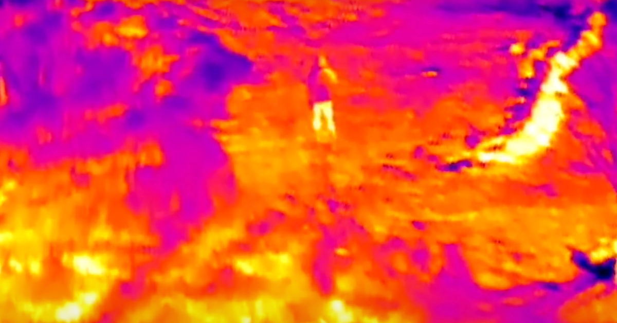
How Thermal Cameras Work
Thermal cameras do not rely on sunlight. They detect infrared energy, which every object emits as heat. Warmer areas appear brighter, while cooler areas appear darker. That contrast helps identify problems quickly.
For example, a roof may look fine in daylight. A thermal view may reveal trapped moisture or insulation gaps. That is the real value.
Types of Drones with Thermal Imaging
Thermal drones come in different categories based on their use.
Compact Inspection Drones: These are lightweight and easy to deploy. They are ideal for quick inspections and smaller sites. They offer a balance between portability and performance.
Industrial Grade Drones: These drones are built for demanding work. They handle longer flight times and carry advanced sensors. They are used for infrastructure, utilities, and large scale inspections.
Dual Camera Systems: Many drones combine a thermal sensor with a high resolution visual camera. That allows you to compare heat data with real world visuals in one frame.
Each type serves a purpose. The right choice depends on the work you plan to handle.
Key Features That Matter Most
Not all thermal drones deliver the same results. Some features make a real difference.
Thermal Resolution: Higher resolution gives clearer heat data. It helps detect smaller issues that may go unnoticed on lower quality systems.
Temperature Range: A wide temperature range allows accurate readings across different conditions. That is important for inspections and emergency response.
Image Blending: Some drones allow thermal and visual images to merge. That makes it easier to pinpoint exact problem areas.
Flight Stability
Stable flight ensures clean and readable data. Any shake can affect accuracy.
These features shape how useful your drone will be during real work.
Where Thermal Drones Make the Biggest Impact
Thermal drones are not limited to one industry. They serve many purposes.
Building Inspections: They detect heat loss, moisture, and insulation gaps. That helps property owners fix issues before they grow.
Electrical Inspections: Hotspots in electrical systems can signal risk. Thermal drones identify those areas quickly and safely.
Search and Rescue: Heat signatures help locate people in low visibility conditions. That saves time during critical situations.
Construction and Site Monitoring: Thermal data helps track changes and detect hidden issues across large areas. Teams offering thermal drone services rely on these applications to deliver real value across different projects.
Choosing the Right Setup for Your Work
Picking the right thermal drone is not about buying the most advanced option. It is about matching the tool to your needs.
Ask yourself:
What type of projects will you handle
How large are the sites
What level of detail do you need
How often will you use it
A compact drone may work well for quick inspections. Larger projects may require more advanced systems with higher resolution.
Clarity on your goals helps you make the right decision.
What We Focus On During Thermal Projects
Every project requires a thoughtful approach. We do not rely on a single setup for all work.
Before starting, we look at:
The type of structure or site
Environmental conditions
The level of detail required
The final output expected
We also plan flight paths carefully. That ensures complete coverage and accurate data collection.
Thermal work is not just about flying a drone. It is about capturing data that leads to better decisions.
Final Thoughts
Thermal drones bring a different level of insight to aerial work. They help detect issues that remain hidden in standard visuals. The best thermal drone is the one that fits your work and delivers clear, reliable data. Focus on resolution, stability, and real world performance.
With thermal drone images, we focus on capturing clear heat data that supports real decisions. At Aerial Perceptions LLC, we choose the right tools for each project and keep every step efficient and practical. When you need accurate thermal insights, we are here to help you move forward with confidence.
FAQs
-
Thermal drones are used to detect heat differences across surfaces and structures. They help identify issues such as energy loss, electrical faults, and moisture buildup. They are also used during search operations to locate people or animals based on heat signatures in low visibility conditions.
-
The cost of a thermal drone survey depends on the size of the site, complexity of the work, and level of detail required. Smaller inspections may cost less, while larger or more detailed surveys require more time and advanced equipment, which increases the overall cost.
-
Drone services include aerial photography, video production, inspections, mapping, and thermal imaging. Each service is tailored to specific project needs. Drones help capture accurate data, improve safety, and provide visuals that support better planning and decision making across different industries.
-
The best thermal drone depends on your specific needs. Drones with higher thermal resolution, stable flight, and reliable sensors work best for professional use. The right choice should match your project type and deliver clear, consistent heat data across different conditions.